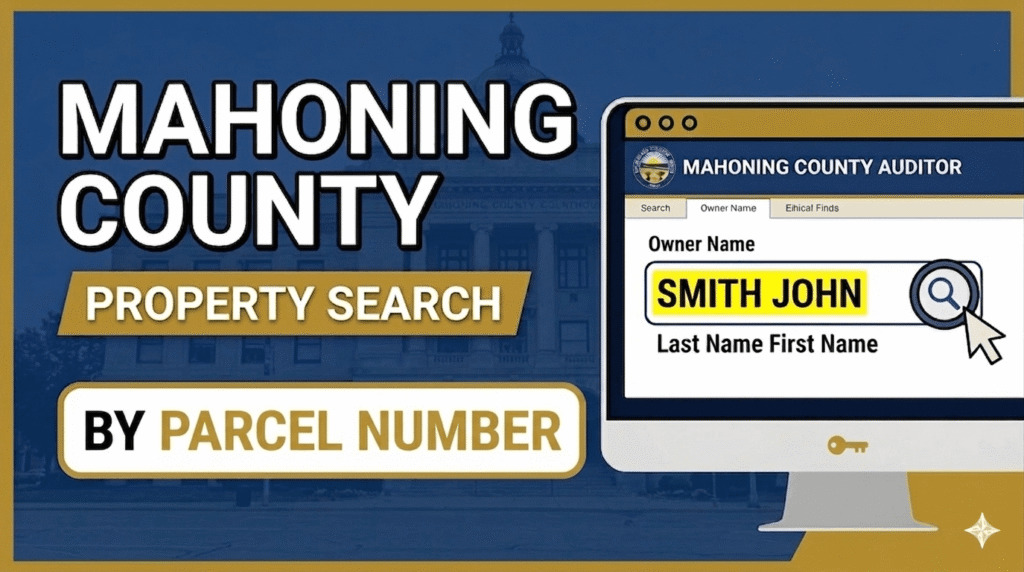
Performing a Mahoning County property search by Parcel ID is the most direct way to access 2026 tax records and official valuations. By entering your unique parcel number into the Auditor’s Advanced Search, you can view current tax year 2025 rates (payable in 2026), which range from 53.28 to over 102.59 mills depending on your district. This method ensures you capture critical data like the 10% late penalty deadline of March 6, 2026.
Official Parcel ID Search Portal
Enter a 12 or 13-digit Parcel Number to access certified property valuations, tax distribution graphs, and official land records.
Source: Mahoning County Auditor’s Office (.gov)
How to Conduct a Mahoning County Property Search by Parcel ID
Searching by Parcel ID (also known as a Parcel Number) is the most precise way to find property data. Unlike names or addresses, a Parcel ID is a unique fingerprint for a piece of land, ensuring you get the exact record every time.
1. Locate the Parcel ID
Before searching, you can find the Parcel ID on:
- Previous property tax bills.
- A legal deed or mortgage document.
- The “Property Summary” page if you previously searched by address.
2. Steps to Search by Parcel Number
Once you have the 12-digit or 13-digit number, follow these instructions on the Mahoning County Auditor’s website:
- Select “Parcel Search”: Choose the Parcel ID option from the search menu.
- Enter the Full Number: Type the complete parcel identification number.
- Formatting Tip: You can enter the number with or without dashes and dots (e.g.,
53-123-0-456.00-0). The system is designed to recognize the sequence of numbers regardless of the separators. - Click Search: The system will immediately open the specific Property Card for that parcel.
3. What Information is Linked to a Parcel ID?
Because the Parcel ID is the official identifier, the data provided is highly detailed:
- Legal Description: The official lot number and subdivision name.
- Assessment Data: The 35% taxable value used by the county.
- Tax Distribution: A breakdown of exactly how many dollars go to your local schools, police, and parks.
- Land Use Code: Indicates if the property is residential, commercial, or agricultural.
Conclusion
Utilizing a Mahoning County property search by parcel is the most foolproof method for accessing real estate data. By bypassing the common errors associated with similar owner names or complex street addresses, the Parcel ID provides a direct link to the county’s official 2026 digital records.
FAQs
What is a Mahoning County Parcel ID?
It is a unique 12 or 13-digit identifier (e.g., 53-123-0-456.00-0) assigned to every piece of land. It acts as a “Social Security Number” for the property, ensuring you pull the exact record regardless of name or address changes.
How do I find my Parcel ID if I don’t have it?
The easiest way is to use the Address Search on the Auditor’s site. Once you locate the property, the Parcel ID will be displayed at the very top of the Property Card.
How do I appeal my parcel’s valuation?
If you believe your property’s value is incorrect, you must file a complaint with the Board of Revision (BOR). The strict deadline for 2026 filings is March 31, 2026.
Can one owner have multiple Parcel IDs?
Yes. If someone owns several adjacent lots or different properties throughout the county, each will have its own unique Parcel ID. You must search each one individually to see the full tax obligation.